District ProfileAdministrative
- Division
- Tirhut
- District Headquarters
- Muzaffarpur
- Geographical Area
- 3,173 km²
- Population (2011 Census)
- 48,01,062
- State & Country
- Bihar, India
Comprehensive tracking of public infrastructure projects, active tenders, cabinet approvals, and development data for Muzaffarpur, Bihar.
Muzaffarpur in Bihar
151
Tracked ProjectsPublic works recorded₹3,139.58 Cr
Total InvestmentApproved project outlay₹3,460.97 Cr
Total Tender ValueState + Central + CPWD48,01,062
Population (Census)Official 2011 CensusAmong Bihar's 38 districts · 2011 Census
48,01,062 people · 4.6% of Bihar
3,173 km² · 3.3% of Bihar
1,513 per km² · Bihar average 1,097
Construction and Upgradation to Four Lane from Manikpur (Design.Ch. Km 0.000) to Sahebganj (Design. Ch. Km 44.650) section.
Road Infra · Muzaffarpur, Bihar
BLACK TOPPING OF RIGHT SERVICE ROAD FROM R.D. 538.00 TOR.D. 839.50 OF TIRHUT MAIN CANAL
Water Resources · Muzaffarpur, Bihar
Construction of ROB of span (1x25m+2X20m+52m BSG+11x25m+3x30m) & Ramp Viaduct (1x25m+1x20m) with approach in Lieu of L.C. No. 7 SPL at Railway Km 47/10-11 between Turki-Ramdayalu Nagar Railway station on Muzaffarpur-Hajipur Road in district of Muzaffarpur.
Road Infra · Muzaffarpur, Bihar
RESTORATION AND LINING WORK OF TIRHUT MAIN CANAL FROM 223.11 KM (RD 732.00) TO 240.85 KM (RD 790.00)
Water Resources · Muzaffarpur, Bihar
Construction of ROB of span (5x30m Viaduct+ 76.080M BSG+ 4x20.64M viaduct+1x60m Rotary+ 5x30m Viaduct) with approach and extra legs on both side of NH-28(New NH-122), in Lieu of L.C. No. 4A at Railway Km 50/36-38 between Muzaffarpur – Ramdayalu Nagar Railway station in between Maripur Power house chowk - NH-28 (GOBARSAHI CHOWK) Dumri On Existing MDR Road in district of Muzaffarpur.
Road Infra · Muzaffarpur, Bihar
RESTORATION AND LINING WORK OF TIRHUT MAIN CANAL FROM RD 704.35 (214.68 KM) TO RD 732.00 (223.11 KM)
Water Resources · Muzaffarpur, Bihar
560 CAPACITY RESIDENTIAL (CO - ED ) SCHOOL AT KOLHUWA PAIGAMBARPUR , KANTI , DIST - MUZAFFARPUR , BIHAR .
Infrastructure · Muzaffarpur, Bihar
CONSTRUCTION OF 720 BEDDED CAPACITY FOR SC/ST (10+2) RESIDENTIAL CO-ED SCHOOL,BUILDING AT-MUSHARI BLOCK (RAJWADA) ,DISTT- MUZAFFARPUR.
Infrastructure · Muzaffarpur, Bihar
CONSTRUCTION OF 520 BEDED OBC (10+2) RESIDENTIAL GIRL'S HIGH SCHOOL, AT-SAHEBGANJ, DIST-MUZAFFARPUR FOR THE YEAR 2025-26.
Infrastructure · Muzaffarpur, Bihar
PROPOSED CONSTRUCTION OF DR. BHIM RAO AMBEDKAR RESIDENTIAL HIGH SCHOOL BUILDING (720 BEDDED CAPACITY) AT SAKRA BLOCK DISTRICT MUZAFFARPUR FOR THE YEAR 2025-26.
Infrastructure · Muzaffarpur, Bihar
Transfer of 3.15 acres of Gairmajarua Bihar Government land at Mauja-Jarang, Circle-Gaighat, Muzaffarpur, to Bihar State Power Transmission Company Ltd for a 132/33 KV grid substation, on payment of Rs 1,98,45,000
Revenue and Land Reforms Department · Muzaffarpur, Bihar
Payment to M/s Indian Potash Ltd for Motipur Sugar Mill Land
Sugar Industry Department · Muzaffarpur, Bihar
Land Lease to KVS for New Kendriya Vidyalaya, Muzaffarpur (Mushahri)
Revenue and Land Reforms Department · Muzaffarpur, Bihar
CITIIS 2.0 Smart City Projects - Muzaffarpur
Urban Development and Housing Department · Muzaffarpur, Bihar
Land Transfer for 100-bed ESIC Hospital
Revenue & Land Reforms · Muzaffarpur, Bihar
Parts of Muzaffarpur district fall under 2 Lok Sabha constituencies, so it has 2 MPs. MPLADS fund figures are for the current term.
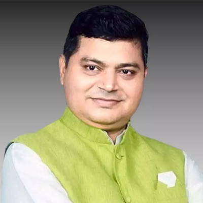
MP, Muzaffarpur · 18th Lok Sabha

MP, Vaishali · 18th Lok Sabha
Live and recent procurement notices matching Muzaffarpur district across Bihar State eProc, Central Govt (CPPP), and CPWD portals.
868notices matched to Muzaffarpur
By portal
Department of Agricultural Research and Education
Bihar State Tourism Development Corporation
Bihar State Tourism Development Corporation
Building Construction Department
Building Construction Department
DG Sashastra Seema Bal,MHA
Urban Development and Housing Department
Bharat Sanchar Nigam Limited (Govt of India Enterprise)
Building Construction Department
Building Construction Department
Muzaffarpur is one of the 38 administrative districts of Bihar, India, situated within Tirhut division. The district is administered from its headquarters at Muzaffarpur. According to the 2011 Census, Muzaffarpur has a recorded population of 48,01,062 and spans a geographical area of 3,173 km².
BiharInfraTales currently tracks 151 public infrastructure projects in Muzaffarpur district, representing an aggregate awarded investment value of ₹3,139.58 Cr. Tracked categories include roads, bridges, public healthcare institutions, schools, and rural water supply works financed by the Government of Bihar and Central Ministry schemes.
5,305 works funded from MLA and MLC constituency development funds recorded for this district.