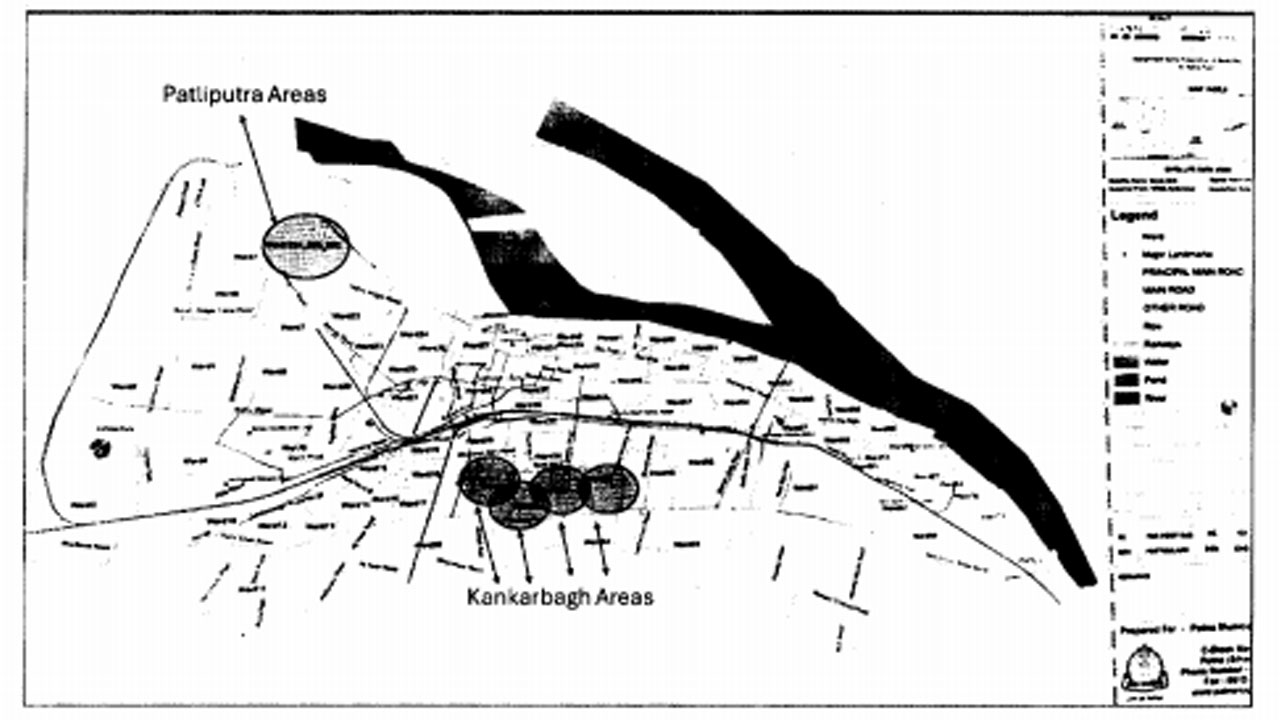
The Urban Development and Housing Department (UDHD) of the Government of Bihar has invited proposals from eligible firms to select a consultant for the preparation of a Neighbourhood Improvement Plan for Kankarbagh and Pataliputra areas in Patna.
Under this initiative, Kankarbagh (Ward Nos. 31, 32, 33, and 45) and Pataliputra (Ward Nos. 22A, 22B, and 22C) have been identified for detailed planning to ensure seamless infrastructure and services. The plan will include proper service level benchmarking of existing facilities.
Kankarbagh, located in the eastern part of Patna, is one of the largest and oldest planned residential colonies in Asia. Over time, it has transformed into a dense, mixed-use urban neighborhood with significant residential, educational, healthcare, and commercial activities.
However, the area faces several challenges such as traffic congestion, inadequate waste management, drainage and waterlogging issues, infrastructure stress, lack of pedestrian-friendly facilities, and neglected inner streets.
Patliputra, situated in the western part of the city, is a rapidly developing locality that combines modern infrastructure with historical significance. Named after the ancient city that once served as the capital of major empires like the Maurya and Gupta dynasties, Patliputra is strategically located between Bailey Road and the Gandhi Setu route, offering excellent connectivity via major roads and the Patliputra Junction Railway Station.
Despite its planned layout and green cover, the area faces problems including drainage and waterlogging, traffic congestion, encroachments, declining greenery, waste management issues, and infrastructure pressure due to commercialization.
The proposed Neighbourhood Improvement Plan will focus on developing safe city streets for women, children, and specially-abled individuals. This includes identifying high-risk zones, mapping schools, improving pedestrian infrastructure, enhancing CCTV surveillance, installing energy-efficient street lighting, and implementing security systems.
Utilities and infrastructure will be digitally mapped, and strategies for urban flooding and stormwater management will be prepared. The plan will also explore the creation of business spaces within the target areas.
The scope of work involves conducting baseline assessments of roads, drains, parks, public spaces, and infrastructure, mapping land use and service gaps, and reviewing demographic and environmental data. Stakeholder engagement will be a key part of the process, with consultations involving residents, resident welfare associations, local businesses, and ward councillors.
Urban design proposals will address zoning improvements, green space enhancement, traffic decongestion, beautification, solid waste management, and public safety. An infrastructure audit will assess the condition and capacity of existing facilities, with recommendations for upgrades.
The plan will be aligned with ongoing government schemes and include a phased implementation strategy with timelines, budget estimates, and identified funding sources such as state schemes, public-private partnerships, and CSR contributions. Key performance indicators will be defined to monitor progress effectively.